Bottom line: Through-hiking the Enchantments in one day will challenge and reward you, but it’s not for everyone.
Why hike the enchantments in a day
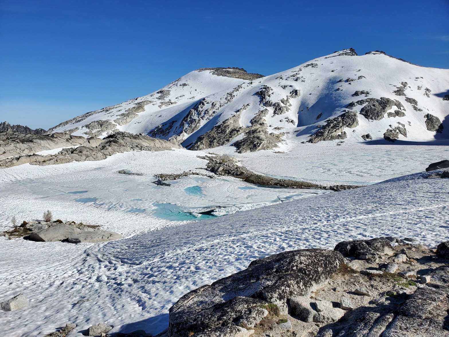
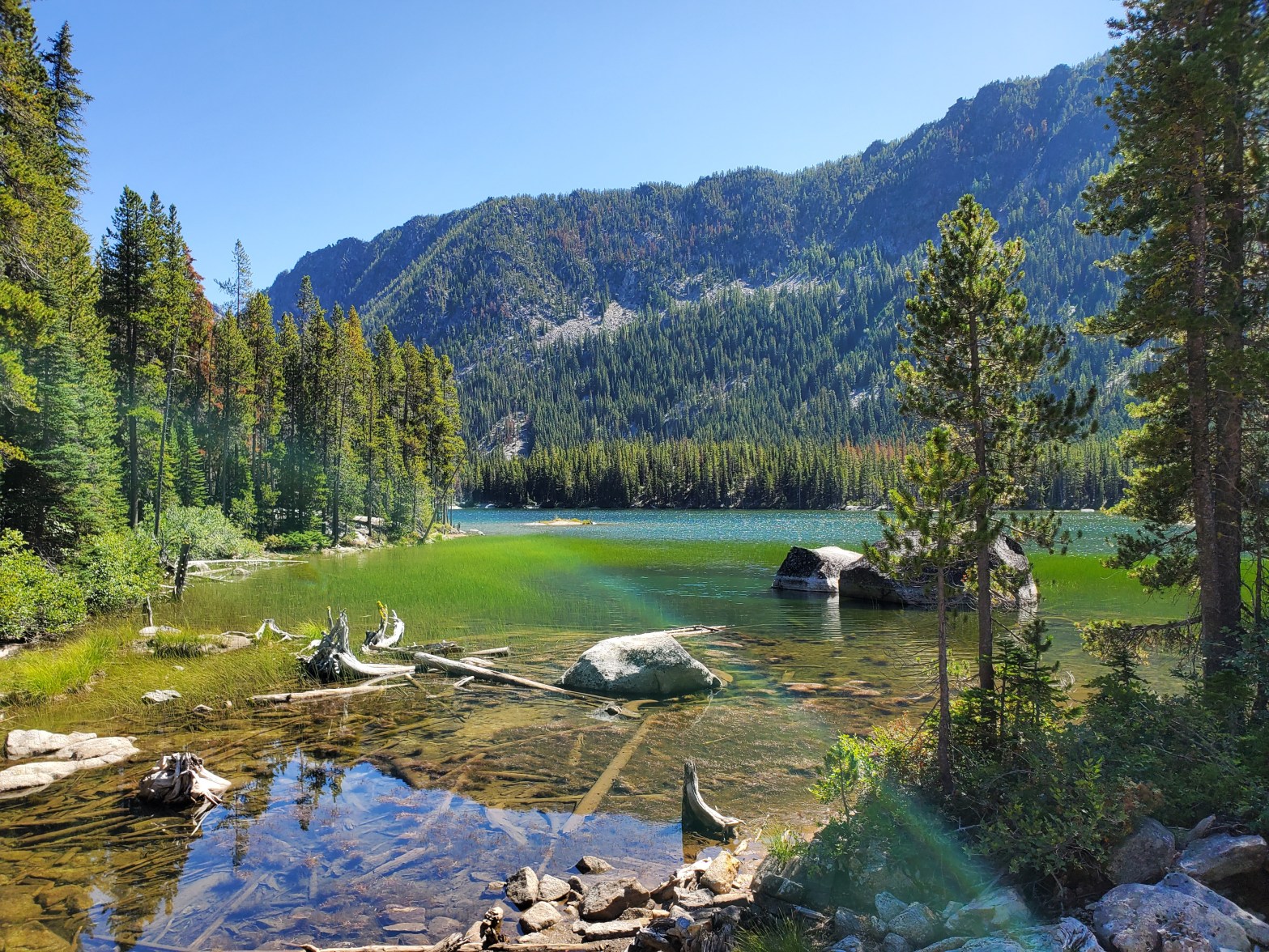
The Enchantment Lakes Basin is known throughout the Pacific Northwest as a beautiful wilderness area. This tiny basin in the Alpine Lakes Wilderness is a little slice of the Sierras in Washington. Pristine alpine lakes strung together by cold, rushing mountain streams dot a rugged landscape of glacier-polished granite and stunted larch trees.
This is my neck o’ the woods. I’d like to welcome you and share some tips for getting the most out of your day hike through the Enchantments.
Backpacking here is by lottery
Backcountry camping permits for this stunning locale are restricted by draconian quota limits and only a lucky few applicants are randomly selected each season.
Who’s bringing team gear, like first aid or an InReach?
Decide which direction to hike
The most popular direction to hike through the Enchantments is counter-clockwise, starting at Stuart Lake trailhead with Colchuck Lake as your first lake and Aasgard Pass as your ascent route. You end lower than you started and it takes less time.
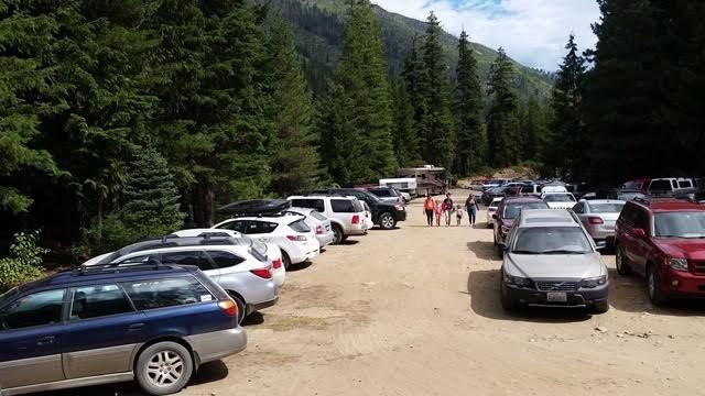
Arrange transportation or a car drop
If you’re planning to use an Enchantments shuttle, make arrangements for that online well in advance.
“It’s an amazing and breathtaking hike, for sure.”
Godwin
It’s go time
Enchantment through hikes start at oh-dark-thirty, so get to bed early. Or stay overnight in Leavenworth or Icicle Creek. There are plenty of hotel rooms and short-term rentals in town and in Wenatchee 30 minutes east.
Emergencies happen. When it happens to you, or to someone you find on the trail, it takes absolute priority. Never leave a distressed hiker unless it is to go for help. In a rescue, more hands make it less work. Once the patient is on their way to definitive care, you can resume your hike — with a story to tell.
Remember that cooler you left in car two? Or the beer and bratwurst you’ll have in Leavenworth? Celebrate your successful adventure!
Congratulations!
“What an amazing day it turned out to be. Certainly the through hike is not a hike. Give it the fullest respect.”
Thru hiker
Where to get more detailed information and current trail conditions for your Enchantments through hike:
Bottom line: July and August are the most popular times, for good reason. The trail conditions and weather are most favorable then.
For most hikers, who are looking for a summer hiking experience, the best time to go is when the snow has melted off the trails but before the weather turns sour in the fall.
The summer days are longer so you can start earlier in the morning and have more daylight to finish your unforgettable hike.
Bottom line: Mosquitoes begin to bug thru hikers as the lake ice melts away, typically in June, and continue through August. They’re worst at lower elevations, such as Colchuck, Nada, and Snow Lakes.
If you’re day hiking through the Enchantments from the time the temperatures stay above freezing all night, thru August, you’ll want to be prepared for the bugs.
Bugs start as soon as there’s standing water available, sometime in May or June. By mid September the mosquitoes are gone for the winter. I assume they move to Florida, IDK.
Insect repellant is one of my essentials to pack on the thru hike. Some hikers completely avoid insect repellants and instead use mosquito net clothing items. Head nets are most popular.
A friend and I tried battery-powered repellants that emit a high-pitched ultrasonic sound — and she discovered that they attracted bees. That doesn’t mean they wouldn’t work for you.
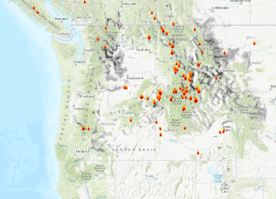
Bottom line: Several online resources help you make an educated guess about wildfire smoke and air quality for your through hike of the Enchantments.
First off, hiking in unhealthy smoke is never a good idea.
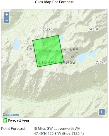
Note: The map shown above is a snapshot and does not represent current conditions. Read on to find a link to that map and more.
Here are some online resources for researching Northwest smoke and air quality levels for your through hike of the Enchantments.
Smoke and air quality index sites
AirNow (US EPA). Map of air quality monitors. (Leavenworth, the closest, is Zip Code 98826.)
AirFire (USFS). Maps of 24-72 hour smoke forecasts. Scroll to “Northwest,” then in the “Today” column, click “MAP” for any of the available models. It can be useful once you learn your way around.
Social media sites include posts of trip reports and photos by hikers who have recently through-hiked the Enchantments. The best of these in my opinion is the “Enchantments Hiking and Backpacking” group.
How to prepare for smoke while on a day hike in the Enchantments
The best preparation for smoke is to carry one N-95 face mask per person. The kind with a ventilator valve are best because you don’t have to rebreathe your exhaled air.
Want a smokin’ hot domain and web site to get started with your outdoor adventure blog?
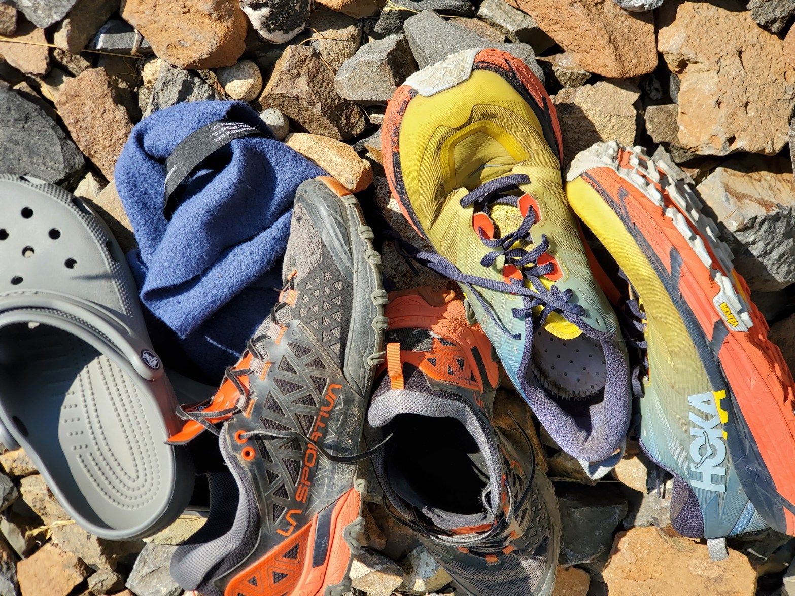
Bottom line: Wear what’s comfortable for you. Most hikers wear trail running shoes in the summer.
Let’s talk about shoes vs boots, YakTrax micro spikes, and all bare our soles about sandals.
Trail runners are versatile so they work well all the way, from Colchuck Lake to Snow Lakes. Water crossing shoes are your choice. (Bring a little towel.)
What about sandals? The Core is largely hikeable in sturdy sandals, Chacos or Tevas, if that’s your thing.
Do you need boots? Before the snow cover has melted off the trail, stiff waterproof boots are nice.
Speaking of snow, micro spikes are advisable in the spring, until the snow has mostly disappeared from the route.
Reason enough to take a quick break and jump in a chilly mountain lake. Colchuck is a visitor favorite but you’ll probably be there early in the morning, when it’s cool and dark.
Inspiration Lake is great for afternoon sunbathing, if you have time. Upper Snow Lake and Nada Lake will be the warmest lakes, relatively.
Jump into adventure blogging and be a resource for your fellow hikers. Get this domain.
Bottom line: There are ways to avoid an eight-mile road hike between the Snow Lakes and Stuart Lake trailheads after a long day on the trail.
The absolute best option is to have a friend or family member drop you off in the wee hours and pick you up that night. Here are some other options.
Leavenworth Shuttle & Taxi LLC operates regular runs between trailheads in the morning. Phone (509) 548-7433. Book online. They pick you up at the Snow Lakes trailhead and drop you at the Stuart Lake trailhead. As of this writing, they have a 2-person minimum and a $30 per hiker fee.
Loop Connector Shuttle operates on a schedule between trailheads in the mornings on weekends. As of this writing the cost is $24 per hiker. They also run on weekdays if your party is 6 or more (or pay the equivalent). Book online. No phone.
Uber drivers will pick you up almost anywhere, including your hotel or a parking lot in town — and take you wherever, including the trailheads. Download the app, register, connect a payment method and go. It’s not the cheapest way, but it operates at your convenience.
Other options: Take two cars. Take an old mountain bike. Hitchhike.
Parking passes required at Snow Lakes trailhead and Stuart Lake/Colchuck Lake trailhead:
You need to display a Northwest Forest Pass or equivalent (not Discover Pass) to park a car at an Enchantments trailhead.
Want the express lane to blogging about your Washington outdoor adventures under a terrific domain name? Buy this one!
Bottom line: Be prepared to spend the night out in the wilderness in case of an emergency or if you simply don’t get out of the Core by dark.
First off, make sure you have the “Ten Essentials.” The Mountaineers has a good 2-page PDF illustrating the ten: Navigation, light, sun protection, first aid, a knife, matches, emergency shelter, food, water, and clothes.
Make sure each person has something, like a Mylar bivy bag and a jacket, to keep from getting hypothermia in case you’re stuck in the basin until dawn.
Dark sunglasses, a shade hat and sunscreen are all important to use.
Your first aid kit can be as large or small as your imagination. You can imagine the possible injuries on a hurried hike like this.
Add to that list of ten essentials: insect repellent (I’d call picaridin an essential on this hike), water purification, a satellite communicator, toilet necessaries, prescriptions you may need en route, trekking poles, and a few bucks in cash.
Collage illustrations by Claire Giordano for the Mountaineers.
Bottom line: Wild mountain goats live here in large numbers and they’re very accustomed to people.
The goats in the Enchantments are famous. Or infamous? They can block your path. They can make cute photos. They can eat your pack.
Remember: This is their home. They live here, you’re just visiting. Be respectful.
The story about Robert Boardman, a hiker who was gored to death, took place in 2010 in Olympic National Park, not in the Cascades. That particular goat was known for aggressive behavior. The Park Service relocated the goat to the Enchantments. (Just kidding, they killed it.)
Want a killer domain name for your adventure blog or site? Buy this one.
Bottom line: Not likely. You’re much more likely to encounter goats than bears.
Bears are rarely noticed by hikers in the Enchantment Lakes. There are no reports of grizzly bears (nor polar bears). Black bears are shy unless threatened. Give them space and they’ll generally move away.
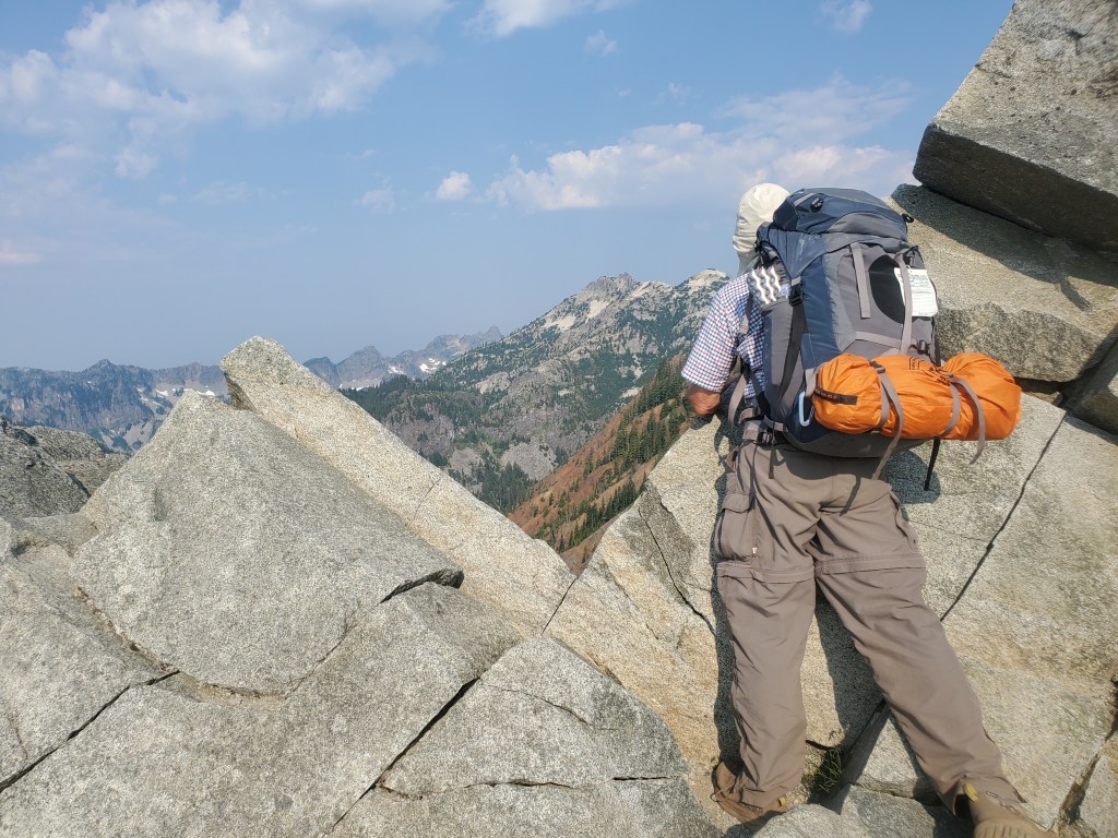
Bottom line: A satellite communicator or PLB of some kind is a great idea for your safety while day-hiking through the Enchantment Lakes, because there is virtually no cell service there.
Helicopter hovering over the Enchantment Lakes Basin. PC: Joshua C.
Except for a few lucky spots for certain mobile carriers, there will be no cell coverage in the Enchantments anywhere along the trail. That means, to be safe and self-reliant, you would need to have a satellite communicator, personal locator beacon (PLB) or other means of calling for help.
The Garmin InReach Mini and InReach Messenger devices are the most popular. There also are several alternatives to the InReach. Look through the options and consider device cost, signup fees, and monthly or annual plan costs.
Don’t use the big red SOS button just because you’re exhausted or it’s getting dark. Poor planning, by itself, isn’t an emergency.
Give your adventure blog its own place in the cloud. Buy this domain.
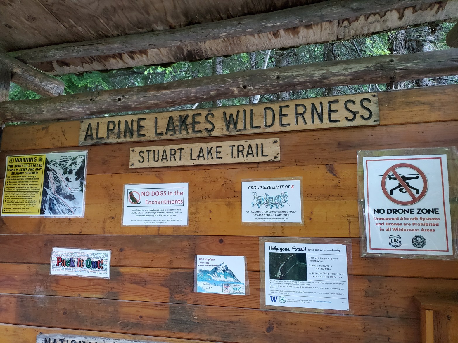
Bottom line: For a day hike in the Enchantments, you need a self-issued permit, which is available at the trailhead.
For day hiking through the Enchantments, you need a day hiking permit. Day permits are self issued at the trailhead and free with no quotas.
At each trailhead – Snow Lakes and Stewart Lake – stop at the bulletin board and look for a box with blank permits in it. The rest is pretty self-explanatory.
Mount Si, of course, is a good training hike for any alpine adventure. It’s not long but it gains elevation similar to Aasgard Pass.
Mailbox Peak is a perennial favorite with local hikers. There’s actually a mailbox at the top!
If you live in the South Sound region, head for Mount Rainier National Park. Camp Muir, Spray Park or Indian Henry’s Hunting Ground are beautiful hikes, and there are many other options once you are in the park.
“We trained for it but nothing could really prepare you for the variety of climbing and hiking you do in this trek.” –Kate, thru hiker 2022.
When I ask PCT hitch-hikers about the most scenic part of the PCT so far, they often say it was the Goat Rocks Wilderness of Washington in section H.
And the most memorable? The Knife Edge gets compared to lofty spectacles like Forester Pass in the Sierras.
Goat Rocks is indeed the highlight of section H. It comes just a day before exiting the section at White Pass.
If you’re not hiking the full section, you can enter via Walupt Lake and pick up the PCT at Sheep Lake. The best thing about Sheep Lake is the marketing. It does have some nice tent sites, good swimming and ample July wildflowers.
The PCT straddles a divide between the Goat Rocks Wilderness and the Yakama Indian Reservation, which features expansive vistas of untrammeled wilderness. It even dips into the Yakama Nation for a mile between Sheep Lake and Cispus Pass.
North of Cispus River are a couple of dry campsites with nice views. One thru hiker told me he stayed in one of them the previous night and it was the best tent spot of the entire trail for him.
It’s worth taking an extra day to explore west of the PCT in the Goat Rocks Wilderness. Snowgrass Flats is a lovely, easy stretch of trail through alpine meadows. Goat Lake sits in a rugged basin with numerous campsites (and even more numerous weekend campers).
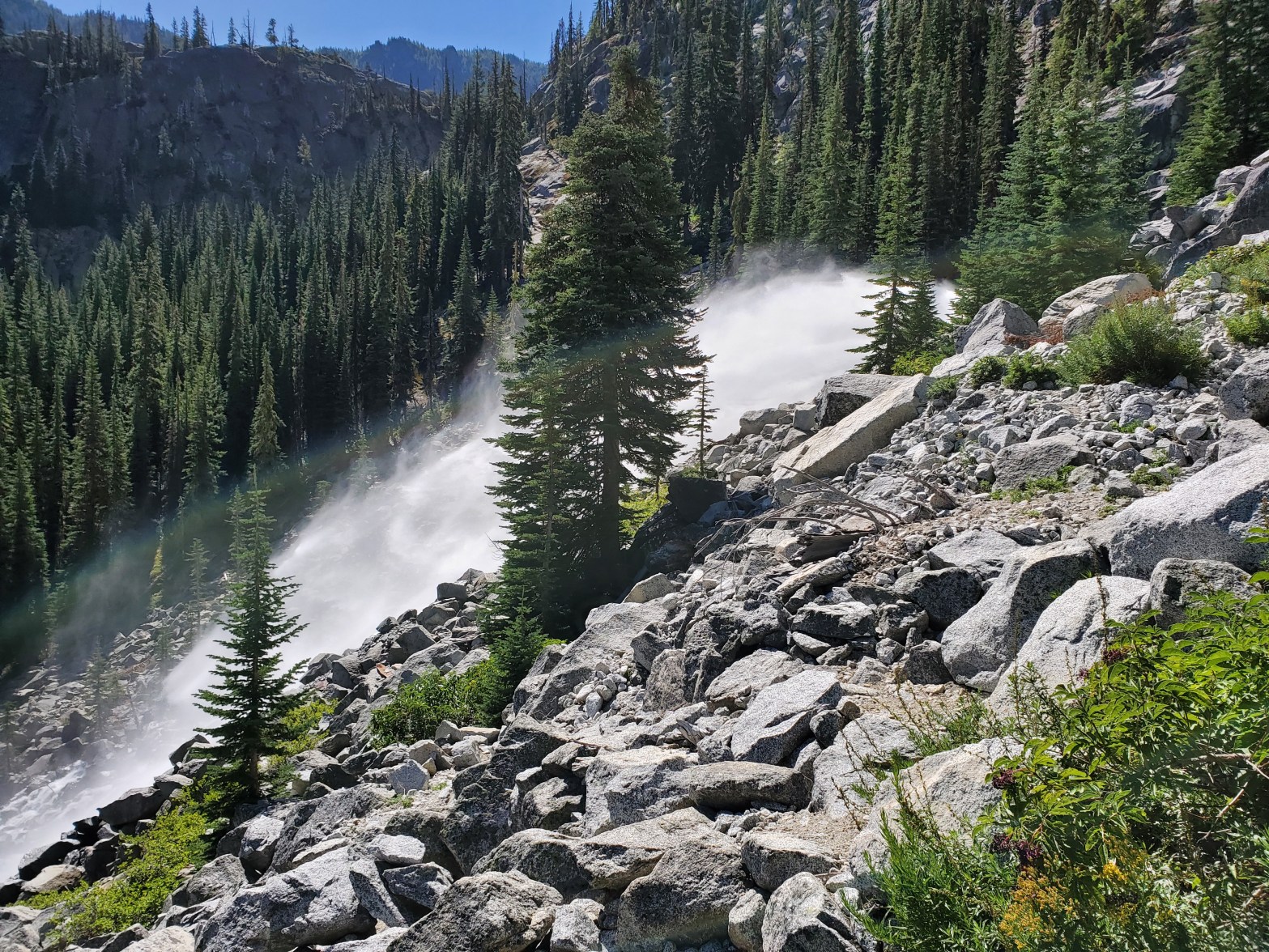
Side trip opportunities begin with trail 97, which connects to Lily Basin trail 86. The scenery north along trail 86 becomes increasingly jaw-dropping as you approach Goat Lake with its tall waterfall spilling into alpine meadowland. The “no camping” imperative doesn’t restrict your options if you camp on trail and there are several sites around the 86-96-97 junctions.
Unfortunately there’s not an easy way to reconnect with the PCT once you detour to Goat Lake. The best way back to trail is to backtrack via trail 96.
You’ll be glad you didn’t miss this section of the PCT as it approaches the base of Old Snowy Mountain. A cluster of tent sites are on trail at 7000 feet just south of the mountain with beautiful views, gusty exposures, and water within 1/4 mile. Mount Adams is visible from half the sites, and Mt. Rainier is visible from the others. There might be a site hidden in the shrubs with views of both.
Ask SOBOs about the blue vs red trail alternatives. The glacier is very small these days, but persistent snow from year to year could influence your decision to cross it. If you’re scrambling Old Snowy, you need the alternate route anyway.
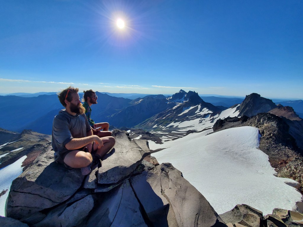
Old Snowy is worth scrambling on a clear day. See photo. Nuf said.
Old Snowy Mountain summit
There are a couple of airy tent sites on the trail to Old Snowy, including one just below the summit block.
The Knife Edge has quite a reputation. Whether or not you have issues with balance or vertigo, take your time and watch your step. The scenery from up here is amazing, and the last grand views of section H before you drop into trees and ski resort infrastructure toward highway 12, Kracker Barrel and the Packwood shuttle.
My hiking partner “Big Boots” and I hiked the Pacific Crest Trail about 65-70 miles from Stevens Pass on US 2 to Snoqualmie Pass on I-90 in Washington.
I had heard from PCT thru hikers that this was one of the best sections of the Mexico-Canada long trail. We were not at all disappointed.
The wildflower hike from Stevens Pass south on day 1 was our first treat, along with a nice campsite at Deception Lakes.
Cathedral Pass
As we ascended to our day 2 camp at Cathedral Pass, the views kept getting better.
Camping at Cathedral Pass offers 360 degree views including the peaks of the Enchantments
The “dangerous creek crossing” of the Cle Elum River was low enough at 11:00 am to rock-hop the first channels and wade the final one in knee-deep fast water. On the morning of day 3 we had excellent views of Mt. Daniel and Mt. Hinman from the trail near the turnoff for Peggy’s Pond.
It was a heat wave and this was the hottest day. We swam in the Waptus River and skipped Escondido Pass. Hikers were bailing out left and right because of the heat (and heat exhaustion). We heard of four in one day, two of whom had to be helped back to the road.
We found the campsite on Waptus Pass for night 3. We hiked on day 4 past Pete Lake, Lanham Meadows, Delate Creek falls and footbridge, to camp at Spectacle Lake.
Spectacle Lake
Spectacle Lake camp with a red sunset due to weather and wildfire haze moving in
Is it spectacular? Hiking uphill through the burn on a hot day certainly wasn’t. Delate Falls were nice. Spectacle Lake has a great marketing name that attracts crowds, who can be there in a day from the Pete Lake trailhead.
The lake is different, not the usual alpine lake ringed with trees and brush. It’s a big lake, bifurcated by a peninsula where most people camp.
Spectacle Lake is very popular, full on weekends, and nice to swim in. Our one night of rain happened there. We camped 2 nights on the tip of the peninsula, explored the lakeshore and relaxed.
Day 6 we hiked across Chikamin Peak to Ridge Lake and Gravel Lake. Ridge Lake is nice swimming.
Kendall Katwalk
Kendall Katwalk
Day 7 we hiked the horse-friendly, hiker-endless switchbacks from Kendall Katwalk to the PCT North trailhead at Snoqualmie Pass.
We met several nobo thrus on that day. We enjoyed conversations with most of them. Though we didn’t hike from Mexico to Canada ourselves, at least we can be cool by association.
Our rides weren’t there yet, so we walked over to Summit Inn for hot food and beer.
Overall we tried to keep our days to 10 miles plus 4,000 feet, or the equivalent thereof. For PCT trailhead transportation, our spouses dropped us off at Stevens Pass and met us at Snoqualmie Pass.
We carried a Spot X and left instructions for how to pick us up at various bail-out points (Hyas, Waptus, Pete), but that wasn’t necessary for us. We hiked the section, sweated the climbs in the heat, and had a terrific time!
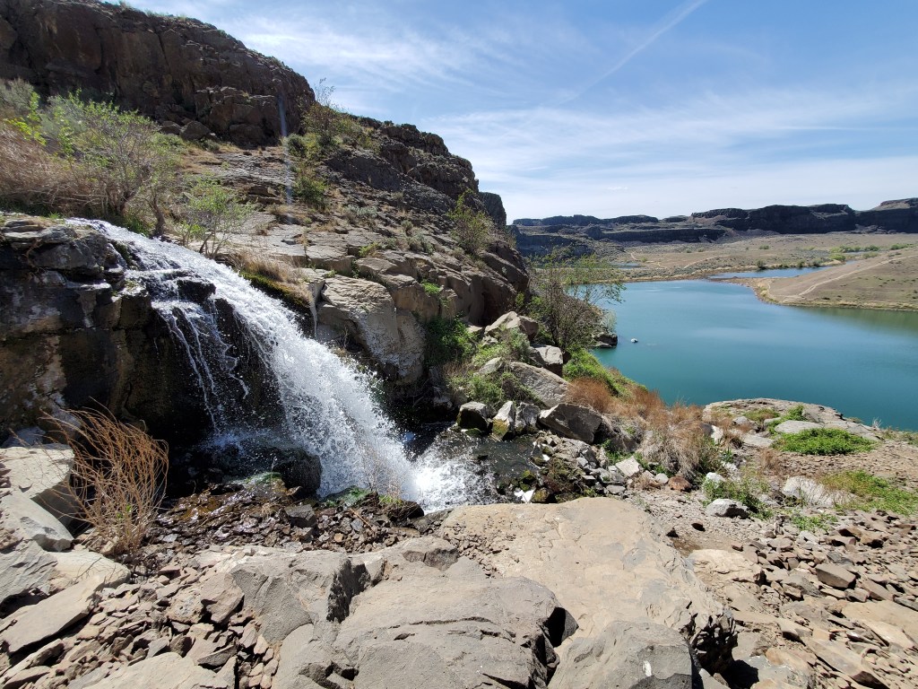
An east-central Washington hike where trail conditions allow very early season visits (and the heat discourages anything later).
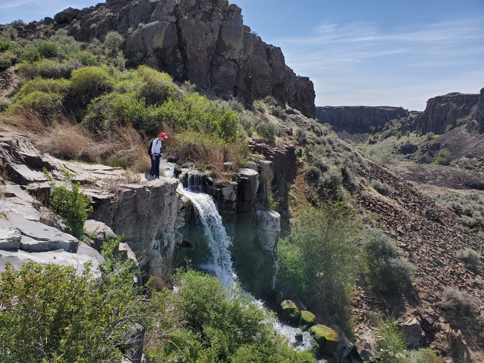
March and April are a good time to visit Ancient Lake. The vegetation is green, flowers are in bloom and the air is cool. Plus the waterfalls are running strong, making for good photos. In very early spring, water also spills over the cliffs overlooking the lake. By April, they are dry.
Falls feeding Ancient Lake
Two main trailheads access Ancient Lake. The upper trailhead approaches from Quincy Lakes to the east. You’ll pass H Lake, Judith Pool, two waterfalls, and some other potholes. The potholes and Ancient Lake are collectively are known as Ancient Lakes. It’s a short, pretty walk, with a little ascending on the way back.
Reeds above Judith Pool
The other trailhead approaches from the west and reaches Ancient Lake by an even shorter, flatter trail.
We encountered no rattlesnakes, but they are known to live here.